Skip to content
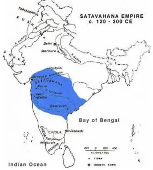
A historical map titled SATAVAHANA EMPIRE c. 120 - 300 CE, showing the Indian subcontinent in black outline on white. A large blue shaded area covers the central and western Deccan, labelled SATAVAHANA, with smaller labels for Nasik, Junnar, Paithan, Amaravati and other sites. Dotted markers indicate towns, and the map key gives a scale in kilometres. Labels mark the Bay of Bengal, the Indian Ocean, Kushan, Ujjayini, Delhi, Mathura and Chola regions. No people are shown.