Skip to content
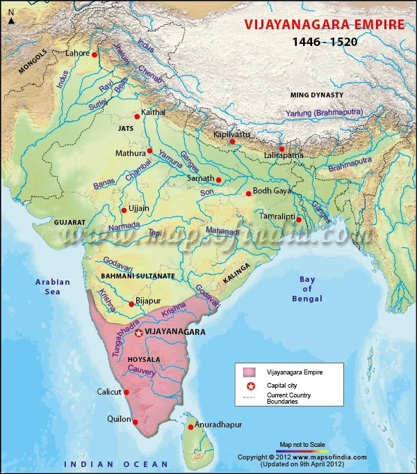
A graphic map of the Indian subcontinent titled Vijayanagara Empire, 1446 - 1520, with blue river lines, grey mountain shading and a pink-filled region covering the south, marking the Vijayanagara Empire with a red star for its capital city. Labels show Hoysala, Bahmani Sultanate, Gujarat, Kalinga, Ming Dynasty, Mongols, the Arabian Sea, the Bay of Bengal and the Indian Ocean, with a legend, a compass arrow and a 'Map not to Scale' note. No people are shown.