Skip to content
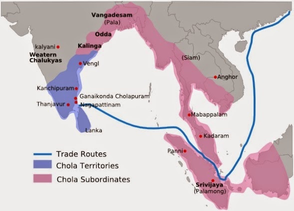
A historical map titled in English showing the Chola empire and its trade routes across South India and Southeast Asia. Chola Territories are shaded blue across the Tamil region, centred near Thanjavur and Tiruvarur on the east coast, while Chola Subordinates are shaded pink along the coasts and in the north, reaching toward Vengi and Kalinga. Western Chalukyas are marked in purple in the northwest. Dark blue lines trace trade routes along the Coromandel and Bay of Bengal coasts, extending to Sri Vijaya (Palembang), Siam, Mahapatam and Kadaram. Place labels include Kanchipuram, Ganga Konda Cholapuram, Sankha, Anghor, Odda, Kalyani and Vangadesam (Pala). The legend in the lower left identifies the two territorial categories and trade routes.