Skip to content
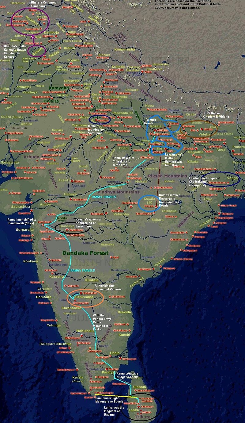
A detailed annotated map of ancient Bharat Varsha (India) with colored labels and overlaid routes. Dense red dots mark city and kingdom locations, with blue, purple and cyan lines tracing Rama's travels from Ayodhya through Chitrakuta, Dandaka Forest, Kishkindha and across the sea to Lanka. Purple circles mark Gandhara and Kekeya, a blue oval marks Mathura, a brown oval marks Videha and a dark circle marks Lanka. Mountain ranges, the Vindhya and Himalayas, and kingdom names such as Kamboja, Kuru, Panchala, Kosala and Dravida are written across the landmass. The map is titled and captioned with explanatory notes about the narrations being based on Indian epics and Buddhist texts, with no people shown.